Washington State Travel Guide
Seattle, Olympic, Mount Rainier, the North Cascades and Walla Walla wine country: what the mountains divide, what each park costs and when to go.
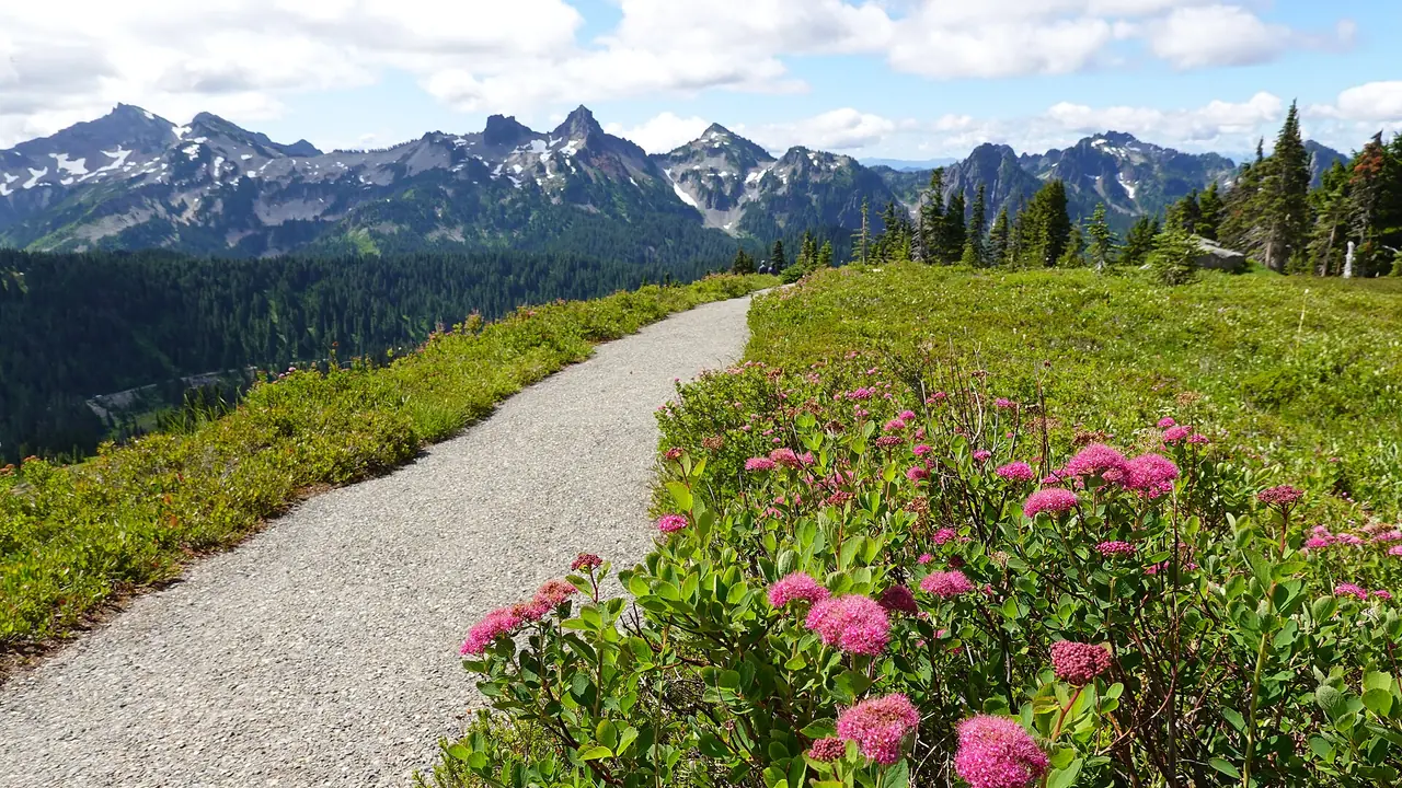
Washington is really two states with a mountain wall between them. West of the Cascades you get Seattle, saltwater, rainforest and three of the country’s more underrated national parks; east of the crest the clouds run out and you’re in dry, sunny farm and wine country. Most first trips stay west, run Seattle plus Olympic plus Mount Rainier in about a week, and that’s a sound plan. The one thing that decides everything else is timing: this state has a short, reliable dry season, and it isn’t where visitors assume.
July through September is the window. Not because it never rains then, but because that’s when the high country is actually open, the mountain passes are clear and the famous view of Rainier isn’t sitting inside a cloud. Come in May and you’ll find snow gates closed on roads that look perfectly drivable on a map. Come in November and the Olympic coast is spectacular and nearly empty, but half the trailheads are unreachable.
Seattle and the water it sits on
Seattle is the arrival point, the airport (Sea-Tac to downtown on Link for $3), and worth two or three days on its own - the market, the museums, the coffee, the food. Our guide to things to do in Seattle handles the city in detail, and where to stay in Seattle sorts the neighborhoods and the lodging tax you pay in each one. What’s worth understanding at the state level is the water: Puget Sound cuts the region into peninsulas and islands, and the ferries aren’t a novelty ride, they’re the road network.
Washington State Ferries is the largest ferry system in the country and turns 75 in 2026. It had already carried over 9.4 million riders by the end of June this year, about 425,000 more than the same stretch of 2025, so summer sailings fill up. WSDOT’s own advice is the advice that works: take an early-morning or late-night boat if you’re bringing a car, or skip the vehicle line entirely and walk on. Walking on to the Bainbridge Island boat is the cheapest good thing in Seattle - you get the skyline, the Sound, the Olympics on the horizon, and a small town with a bookshop and a brewery at the far end.
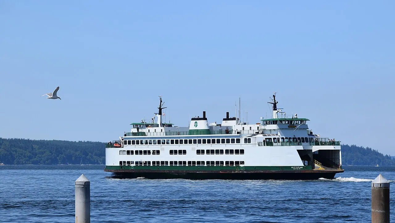
Further north, the same fleet runs from Anacortes out to the San Juan Islands, which are a proper multi-day destination rather than an afternoon: Friday Harbor on San Juan Island for whale-watching trips and a walkable town, Orcas Island for the hiking and the view from Mount Constitution, Lopez for cycling on quiet roads. Vehicle space is the scarce commodity here, and this is one of only two parts of the system where you can reserve it at all - the Anacortes-San Juans run and the Port Townsend-Coupeville crossing. You’ll want to book that slot online as soon as the seasonal schedule drops, or leave the car in Anacortes and walk on, since foot passengers never need a reservation and almost always get aboard.
Olympic National Park
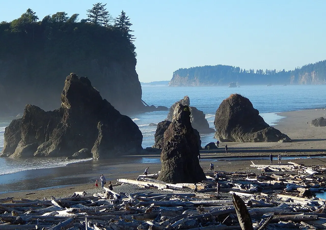
Olympic protects three landscapes that have almost nothing in common: a glaciated mountain core at Hurricane Ridge, temperate rainforest in the western valleys, and about 70 miles of wild Pacific coast, with no road crossing the middle - you circle the peninsula on Highway 101 and drive in and out on spurs, which is why you won’t do Olympic justice in two days and three is honest. Entry is $30 per vehicle for seven days, and the park is cashless, so pay online at Recreation.gov or bring a card. Our Olympic National Park guide covers Hurricane Ridge’s post-fire facilities and 2026 construction, the Hoh Rain Forest, Lake Crescent, Sol Duc and the current coast closures in full.
Mount Rainier, and the 2026 rule change nobody mentions
Rainier is the 14,410-foot volcano you see from the plane, and in 2024 and 2025 getting to its two best areas meant booking a timed entry slot in advance. For 2026 the park has said it won’t run timed entry reservations for any part of the park, and will manage crowds through parking instead. That’s a real change in how you plan: no 7 a.m. scramble for a slot, but also no guaranteed parking space at Paradise or Sunrise on an August Saturday. NPS (updated August 11, 2026) says entering before 10 a.m. or after 2:30 p.m. can help avoid delays when visitation is heavy. Entry is $30 a vehicle for a week, cashless.
Paradise is the subalpine meadow bowl on the south side and peaks for wildflowers in the second half of July into August. The reason it’s so late is buried in the snow numbers: Paradise averages 637 inches of snowfall a year on records going back to 1920, and in 1971-72 it took 1,122 inches, which was a world record. Some meadows are still white in June. The usual “if Paradise is in cloud, drive around to Sunrise” advice is off the table while Sunrise Road stays closed: as of October 23, 2026 NPS lists Sunrise Road, the Sunrise Visitor Center, picnic area and Day Lodge and White River Campground as closed for the season, and its alerts say the Grand Park 2 Fire is still active in the park. Check nps.gov/mora before you plan that detour. Current roads, gates and what’s actually open: Mount Rainier National Park.
North Cascades: free, empty, and full of ice
An hour and a half northeast of Seattle, North Cascades National Park charges no entrance fee at all and gets a fraction of the visitors of the other two. It holds over 300 glaciers - the park calls itself the most heavily glaciated place in the country outside Alaska - and the turquoise water of Diablo Lake is the payoff for a drive that most people do as a long day trip from the city. Don’t expect Rainier crowds here.
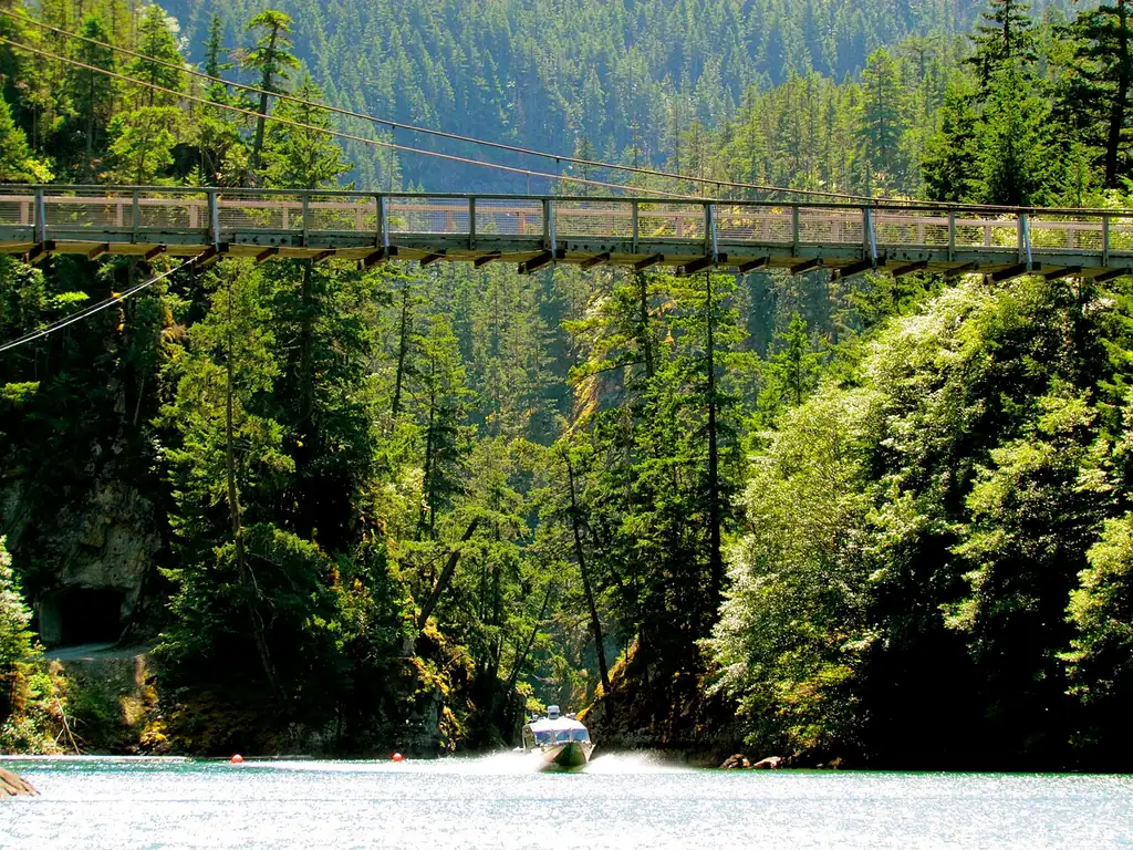
The catch is the road. Highway 20 through the park closes every winter, and the last two seasons show how variable that is: it shut on December 4, 2025 between mileposts 131 and 178, and after an atmospheric river washed out a stretch of roadbed, the eastern half didn’t reopen until April 30 and the full route not until June 14, 2026. Check the WSDOT page for SR 20 before you build a loop around it, especially in spring - you won’t enjoy a surprise closure mid-itinerary.
The dry side: Walla Walla and Washington wine
Cross the Cascades and the landscape flips to sagebrush, irrigation circles and 300-odd days of sun. Washington is a serious wine state, and Walla Walla, in the far southeast corner near the Oregon line, is where it’s most fun to drink: an AVA designated in 1984 with more than 120 wineries, built on Cabernet Sauvignon, Merlot and Syrah. Tasting rooms cluster downtown within a few blocks, which means you can taste without driving between appointments - the single biggest practical difference from Napa. The state line here is a formality for wine purposes: the Oregon travel guide picks up the Willamette Valley, the coast and Crater Lake on the other side of it.
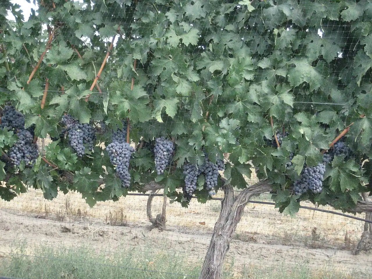
Walla Walla is a four-and-a-half-hour drive from Seattle, so it’s a trip in itself rather than a day out. Fly into Seattle, spend the first half of the week on the coast and the mountains, then either fly home or make the eastward drive part of a longer loop through the Columbia Gorge.
How much time, and what it costs
A week west of the mountains works like this: two days in Seattle, three on the Olympic Peninsula, two at Rainier, with the car picked up on the morning you leave the city. Ten days lets you add either the North Cascades or the drive east to wine country. You’ll want a rental for everything outside Seattle, and gas plus two $30 park fees is the small end of the budget; lodging near the parks is the large end, and it books out by June for August dates. If you’re pricing a loop, compare rental car rates before committing, because one-way drops between Seattle and Spokane or Walla Walla can cost more than the rental.
Weather-wise, ignore the reputation and look at the calendar. The rain here is a winter and spring habit, spread thin across many gray days rather than dumped in storms, and July to September is genuinely dry. Pack a shell anyway: it’s still the Pacific Northwest, and the Hoh doesn’t take 140 inches a year by accident.
Read also
- The city first: things to do in Seattle
- Book the city half: where to stay in Seattle
- The state south of the Columbia: Oregon travel guide
- Compare the parks: Yellowstone and Yosemite, or browse the full national parks index
- Browse more US states and US cities
On the map
The map loads on click - to keep the page lightweight.
The map didn’t load. Check your connection and refresh the page.
Read also

States · 11 min read
Connecticut: Mystic, New Haven and the Shoreline
Verified · September 12, 2026Mystic Seaport at $35 adult, free Yale galleries in New Haven, and Gillette Castle on the river - how a Connecticut weekend actually fits.

States · 9 min read
North Dakota: Medora and Theodore Roosevelt NP
Verified · September 5, 2026The 36-mile South Unit loop starts in Medora, entrance $30 per vehicle, cashless from May 2026 - how to plan Theodore Roosevelt National Park.

States · 9 min read
Arkansas Travel Guide: Hot Springs & Ozarks
Verified · September 4, 2026Fee-free Hot Springs NP downtown, free Crystal Bridges in Bentonville, and the 135-mile Buffalo - how to string an Arkansas road trip.

States · 10 min read
Indiana Travel Guide: Indy, Speedway, Shore
Verified · September 5, 2026IMS Museum at $25, Kiss the Bricks at $15, Brown County hills and Lake Michigan shore - an Indiana trip beyond a Chicago beach day.