
Yosemite National Park Guide: Waterfalls & Timing
No entry reservation in 2026, waterfalls peak in May and June, Tioga and Glacier Point road dates, Half Dome permits, and where to stay near Yosemite.
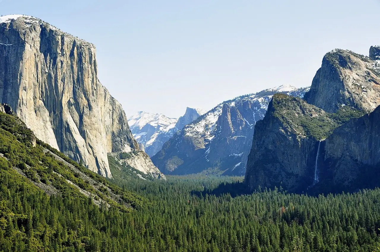
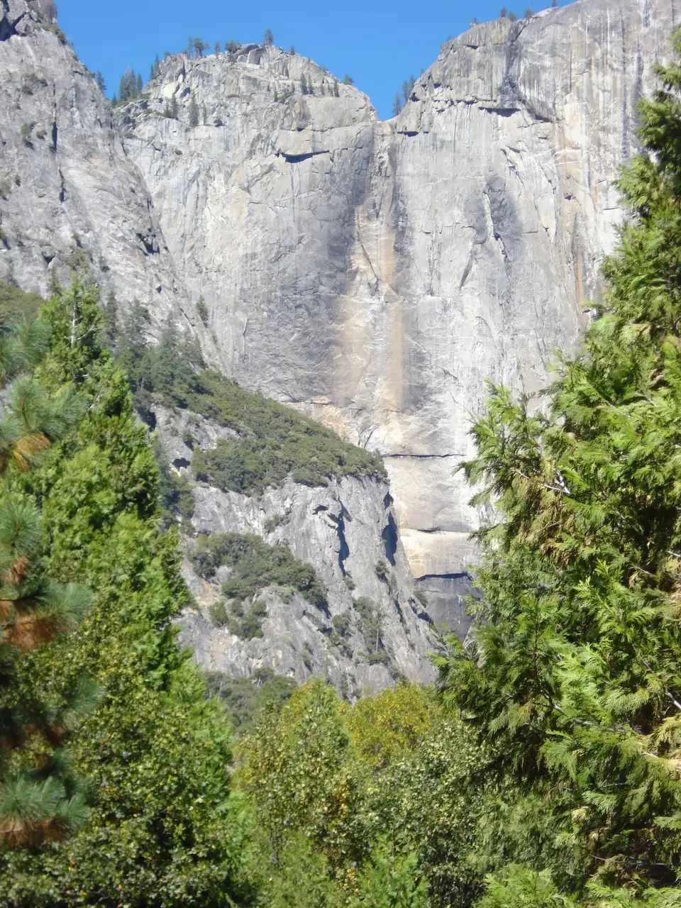
Two questions decide a Yosemite trip, and both have answers that change from year to year. The first: do you need a reservation to drive in? In 2026, no - the park announced it “will no longer use a timed reservation system in 2026” and is managing traffic with parking control and staffing instead. The second: when do the waterfalls run? Peak runoff is May or June, and Yosemite Falls is “often only a trickle or completely dry by August”.
That second fact is the one that quietly ruins August trips. People book the trip around a photograph taken in late May and arrive to a dry granite streak on the cliff. It’s not a bad time to visit - it’s a different park, and worth knowing which one you’re buying.
Reservations in 2026: check, do not assume
Yosemite has run some form of peak-hours entry reservation in several recent years, dropped it, brought it back in modified form, and dropped it again. For 2026 the park says plainly that there’s no timed reservation system, and that congestion is being handled with real-time traffic monitoring, active parking management, extra staffing at peak periods and better visitor information.
Treat that as a fact with a short shelf life. The decision is announced by the park, usually months ahead of the season, and it’s the single item on this page most likely to have changed by the time you read it. Check the reservations page on nps.gov before you build a schedule around a specific arrival time.
What hasn’t changed is the parking reality. Yosemite Valley has a fixed number of spaces and no reservation system for them. On a summer Saturday the day-use lots fill mid-morning. Arriving before 09:00 or after 16:00, or leaving the car at your lodging and using the free shuttle, is worth more than any booking system.
The policy has flipped on and off three times since 2020, and knowing the pattern helps more than knowing this year’s answer: Yosemite Reservations covers the full history, how the $2 fee worked in the years it applied, and which other parks dropped or kept their own systems in 2026.
When do the waterfalls actually run?
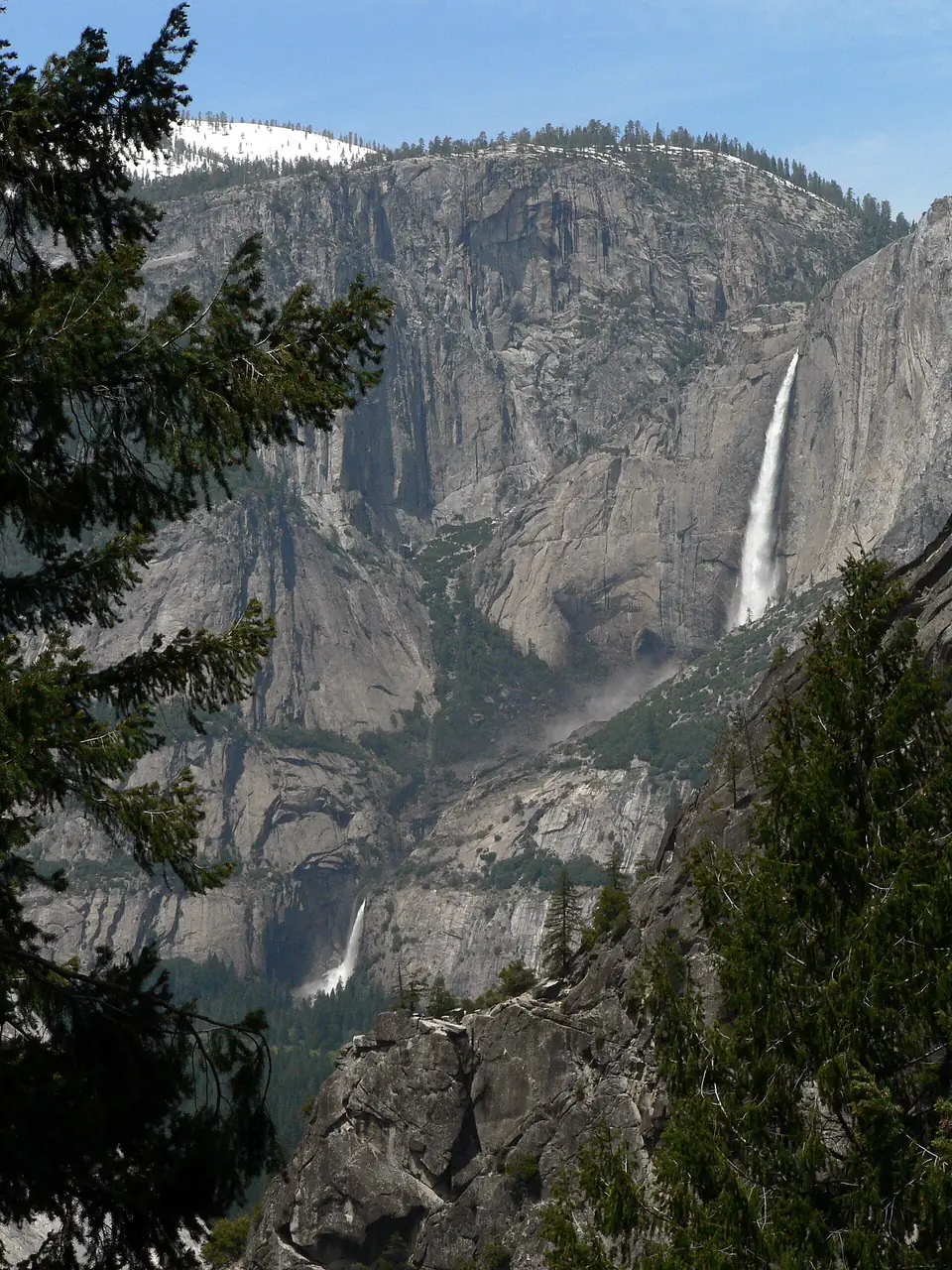
Snowmelt drives everything. Runoff peaks in May or June, which is when the valley walls run with water and the spray on the Mist Trail actually soaks you. By late July flows drop hard, and Yosemite Falls is often a trickle or completely dry by August, staying that way until fall rain and winter snow restart it.
Four falls in and around the Valley run year-round, at reduced volume in late summer: Bridalveil (620 ft), Vernal (317 ft), Nevada (594 ft) and Illilouette. So an August visit isn’t waterfall-free - it just means Bridalveil and the Vernal-Nevada pair on the Mist Trail instead of the headline 2,425-foot cliff.
The practical version:
| Month | Water | Trade-off |
|---|---|---|
| April - early May | rising, strong | Tioga and Glacier Point roads usually still shut |
| Mid May - June | peak | best falls, biggest crowds, all roads opening |
| July - August | dropping fast | Yosemite Falls often dry, high country at its best |
| September - October | low | quiet, warm days, clear granite light |
| November - March | variable | valley open, high roads closed, snow and empty views |
Tioga Road and Glacier Point Road: the other seasonal trap
Yosemite Valley is open all year. The two roads that lift you out of it aren’t.
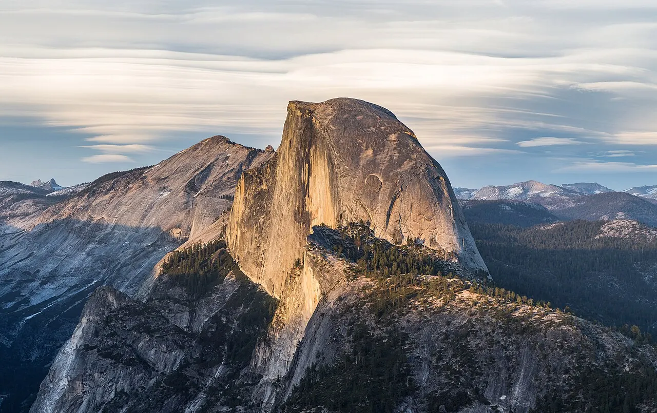
Glacier Point Road carries you to the viewpoint 3,200 feet above the valley floor, looking straight at Half Dome and down onto Vernal and Nevada Falls. It typically opens sometime in May and closes sometime in November. In 2026 it opened at 8 a.m. on Saturday, May 9.
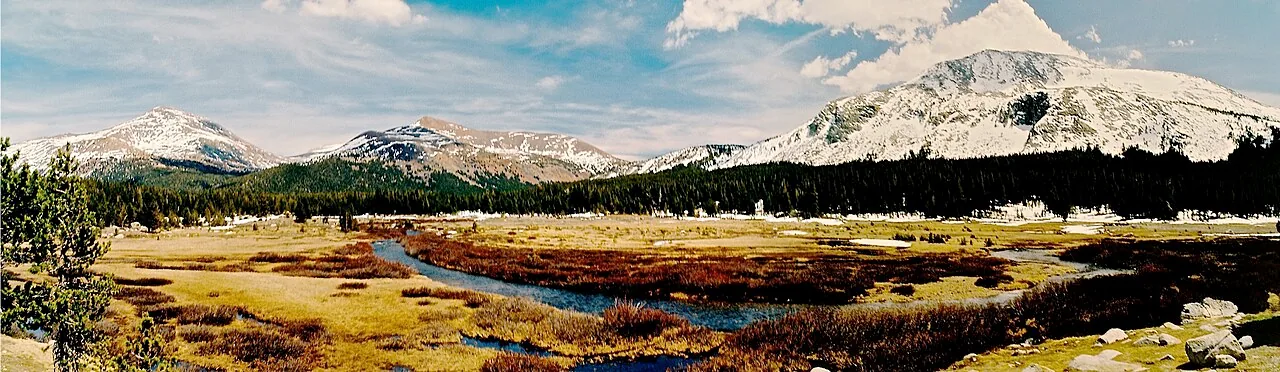
Tioga Road is the high crossing of the Sierra to Tuolumne Meadows, Tenaya Lake and out to the eastern side of the range. It typically opens late May or June and closes in November. In 2026 it opened to bicycles on Thursday, May 14 and to all vehicles at 8 a.m. on Friday, May 15.
Plowing usually starts mid-April, but heavy snow years wreck the timetable: in 2023 the crews didn’t get through the Olmsted Point avalanche zone until June 21. If your plan involves crossing the Sierra by Tioga Pass in early June, have a fallback route, because the alternatives are hours of detour north or south.
Half Dome: a permit, and two ways to get one
The cables up the final granite shoulder go up the Friday before the last Monday in May and come down the day after the second Monday in October, weather permitting. A permit is required whenever they’re up, and a maximum of 300 hikers a day are allowed on the cables - roughly 225 day hikers and 75 backpackers.
Preseason lottery: apply during March 1-31 (eastern time), results in mid-April, 225 permits available per day, up to six permits per application.
Daily lottery: apply two days before your hike date, midnight to 4 p.m. Pacific, with results late that evening. This runs on cancellations and no-shows, so odds vary wildly by day of the week.
Fees are $10 for the application (non-refundable) plus $10 per person if you win, refunded if you cancel by 11:59 p.m. the day before or if the cables aren’t up.
If you miss out, the Mist Trail to the top of Nevada Fall needs no permit and delivers the two best waterfalls in the park at close range. In May and June, expect to be genuinely wet.
Fees and the surcharge for overseas visitors
Entry is $35 per private vehicle for seven consecutive days, covering the vehicle and everyone in it; $30 for a motorcycle; $20 per person on foot or by bicycle, with under-16s free. The Yosemite annual pass is $70 and is sold to US citizens and permanent residents only.
Since 2026, each non-US resident aged 16 and over pays an extra $100 on top of standard entry, unless admitted on an annual or America the Beautiful pass. The non-resident America the Beautiful pass costs $250.
Two overseas adults pay $235 for a single Yosemite visit, or $250 for a pass that covers every federal site for a year. The California angle is Sequoia and Kings Canyon: they’re on the same list of 11 parks that levy the surcharge (as are Zion, the Grand Canyon and Yellowstone), so on a road trip that pairs Yosemite with the southern Sierra a single $250 America the Beautiful Non-Resident pass (holder plus three other adults) can pay off at the second gate. NPS’s own pages disagree on whether a park-only $70 annual pass waives the surcharge, and the only pass NPS explicitly names as covering it’s that $250 one - so confirm at the entrance station before you pay.
Getting around
Two free shuttles run daily in Yosemite Valley: the Valleywide route every 12-22 minutes and the East Valley route every 8-12 minutes, both from 7 a.m. to 10 p.m. Check their current status before you rely on them, but using them instead of moving the car between trailheads is the single best decision you can make in the valley.
YARTS buses connect the gateway towns for a fare: Highway 140 from Merced, Mariposa, Midpines and El Portal runs year-round; Highway 41 from Fresno and Oakhurst, Highway 120 West from Groveland and Sonora, and Highway 120 East from Mammoth Lakes and Lee Vining run in summer only. Arriving without a car is realistic here in a way it’s not at most US parks.
Where to base yourself
- In the valley (Ahwahnee, Yosemite Valley Lodge, Curry Village) - the only way to be at Tunnel View at sunrise. Booked far ahead, priced accordingly.
- El Portal - just outside the Arch Rock entrance on Highway 140, about 30 minutes from the valley, and the best compromise between cost and access.
- Mariposa - a real small town on 140, roughly an hour out, cheaper, with restaurants that aren’t lodge restaurants.
- Oakhurst - on Highway 41 to the south, the base for Wawona and the Mariposa Grove of giant sequoias.
- Groveland - on Highway 120 West, the sensible choice if you’re coming from San Francisco or heading over Tioga Pass.
If you only have one day in the valley
Start before the lots fill. Drive up to Tunnel View on Highway 41 for sunrise - it’s five minutes above Bridalveil Fall and 30 seconds from the parking lot, and it’s the best free thing in the park - then drop into the valley and leave the car at your lodging or a day-use lot. Take the free shuttle between the trailheads rather than moving the car, walk the Mist Trail to the top of Vernal Fall (or on to Nevada Fall if your legs are willing), and give the afternoon to the valley-floor loop under El Capitan and Half Dome. The valley bakes at 4,000 feet in summer while Tuolumne Meadows at 8,600 feet stays cool, so if Tioga Road is open and you have a second day, drive up for the high country and pack for both.
Two housekeeping notes wherever the day goes: food lives in the metal lockers, never the car, because a bear will peel a car open for a sandwich wrapper; and tire chains can be required on valley roads any time from fall to spring, rental car included. The reservation policy, the road-opening dates and the Half Dome lottery windows all move from year to year, so confirm the current ones on nps.gov before you lock anything in - the 2026 no-reservation call above is the single most likely thing on this page to have changed by the time you read it.
Read also
- Giant sequoias and the Generals Highway, further down the Sierra: Sequoia and Kings Canyon
- All our national park guides
- The reservation policy’s full history, and how to watch for its return: Yosemite Reservations
- The mandatory shuttle and Angels Landing permits: Zion National Park
- Rim trails and going below the rim safely: Grand Canyon National Park
- Old Faithful, wolves and winter road closures: Yellowstone National Park
- Free to enter, with only a parking tag: Great Smoky Mountains National Park
On the map
The map loads on click - to keep the page lightweight.
The map didn’t load. Check your connection and refresh the page.
Admission and opening hours
- Admission price
- $35 per private vehicle, $30 per motorcycle, $20 per person on foot or bicycle, valid 7 consecutive days. Yosemite annual pass $70. Non-US residents aged 16+ pay an extra $100 unless admitted on an annual or America the Beautiful pass.
- Opening hours
- Open year-round. In 2026 Glacier Point Road opened May 9 and Tioga Road opened May 15; both usually close sometime in November.
Yosemite is not using a timed entry reservation system in 2026, but this has changed most years - confirm on nps.gov before you travel.
Details checked: July 24, 2026
Read also

National Parks · 12 min read
Canyonlands and Capitol Reef: Utah's Two Quiet Parks
Verified · August 29, 2026Canyonlands $30, Capitol Reef $20 for the Scenic Drive - what each park costs, which district to skip, and which one wins if you only have a day.

National Parks · 8 min read
Indiana Dunes from Chicago: Beaches & the $25 Gate
Verified · August 26, 2026Leave Chicago early for West Beach, the Dune Succession Trail and the South Shore Line to Dune Park. National and state park fees do not cross.

National Parks · 8 min read
Carlsbad Caverns: Natural Entrance and Bat Flight
Verified · August 25, 2026$15 entry plus $1 timed reservation, Natural Entrance vs elevator, Big Room loop, and free bat flights April-Oct.

National Parks · 8 min read
White Sands: Dunes, Sledding and Closures
Verified · August 25, 2026Gypsum dunes, $25 entry, sledding tips, and why missile-range tests can close Dunes Drive for hours - check NPS the morning you go.