
New Mexico Travel Guide
Albuquerque, Gallup, White Sands, Tucumcari neon and the Route 66 choice between Santa Fe and the 1937 cutoff.
New Mexico forces a decision most Route 66 drivers don’t see coming until Santa Rosa. The original 1926 alignment swings north through Santa Fe, then drops down to Albuquerque. The 1937 realignment cuts straight west and saves most of a day. Both are “real” Route 66. Only one fits your remaining nights.
That fork is the planning skeleton for the whole state. Everything else - Albuquerque’s Central Avenue, Gallup’s trading-post strip, Tucumcari’s neon, the high desert light that makes ordinary gas stations look cinematic - hangs off whether you take the Santa Fe loop or keep the pedal down. Travelers from the UK and Australia often underestimate drive times here because the map looks empty; empty still takes hours when speed limits and two-lane stretches slow you down.
The 1926 loop versus the 1937 cutoff
If you have the time, take Santa Fe. The city has its own guide because the plaza, adobe grid and museum tickets deserve more than a paragraph: see things to do in Santa Fe. Budget a night, preferably two, then rejoin the later alignment in Albuquerque. If you’re on a ten-day Chicago-to-LA clock, the 1937 cutoff is the honest compromise - you lose the capital and keep the neon towns.
Neither choice is wrong. The wrong move is pretending you’ll “swing through Santa Fe for two hours” without parking, walking the plaza or eating. That version wastes the detour. Budget at least one overnight if you take the loop - day-trippers from Albuquerque often leave feeling they only saw parking lots.
West of Albuquerque the road climbs toward Gallup and the Arizona line. Gallup still reads as a Route 66 trading town more than a resort, which is exactly why people who like the highway stop there. From Gallup you’re hours from Flagstaff and the best driving on the whole Mother Road - continue into our Arizona travel guide when you’re ready for Petrified Forest, Seligman and Oatman.
The broader Chicago-to-Santa-Monica sequence is in the Route 66 road trip guide.
Tucumcari first: neon that still rents rooms
Coming from Oklahoma or the Texas panhandle, Tucumcari is the emotional gear change. Restored motel signs line the old highway, and the Blue Swallow - built in 1939 and open since 1942 - still rents rooms with a garage beside each door. Book weeks ahead in spring and fall. The National Park Service preservation program helped relight that neon; you’re looking at working heritage, not a facade.
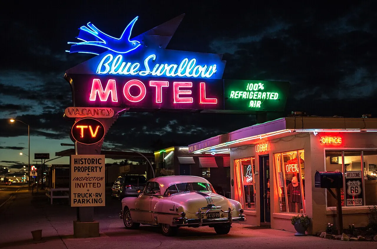
Stay the night if a room is open. Driving past at 4pm and hoping for a vacancy is how people end up in a chain hotel off I-40 telling themselves the neon looked fine from the car.
Albuquerque: Central Avenue and a base that works
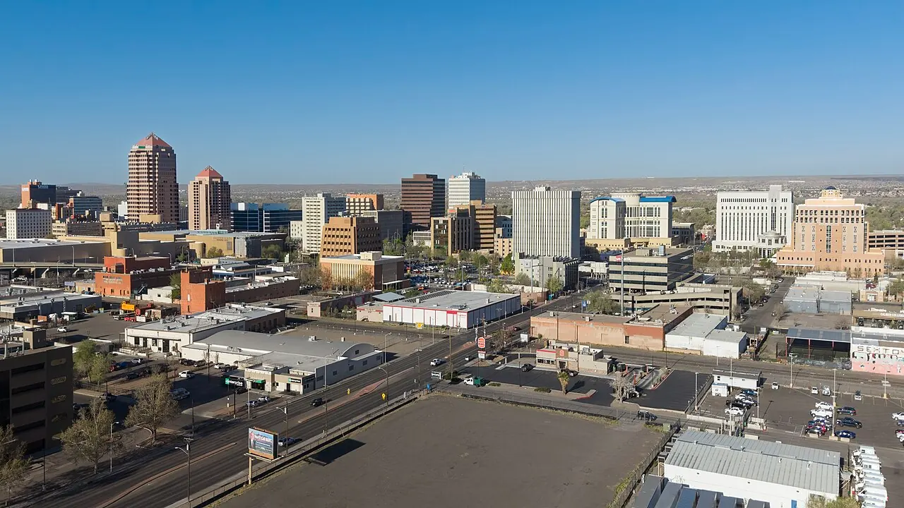
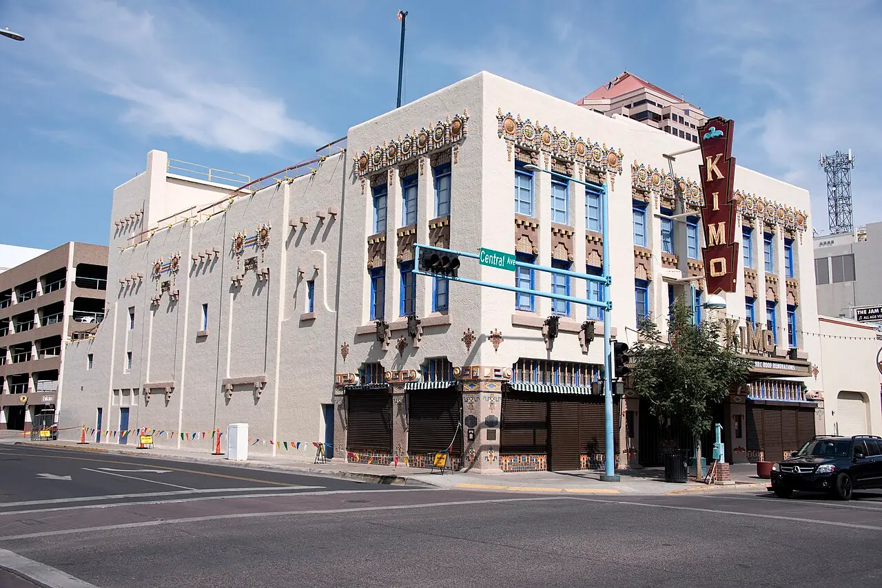
Albuquerque is the practical hub. The airport (ABQ) is the state’s main long-haul gateway, rental cars are plentiful, and Route 66 becomes Central Avenue for roughly eighteen miles across town. You’ll pass the 1927 KiMo Theatre and a run of surviving motel signs through Nob Hill. The city also sits at a useful altitude - high desert rather than low Sonoran furnace - so summer evenings are often livable when Phoenix is not.
Use Albuquerque as a two-night base: one night for Central Avenue and food, one for either Santa Fe or a day trip south. Don’t try to “see New Mexico” from a single downtown hotel without a car - distances look short on the map and eat hours in practice. Evening thunderstorms in monsoon season can delay a White Sands return drive, so keep a flexible dinner plan.
White Sands: the side trip that resets your eyes
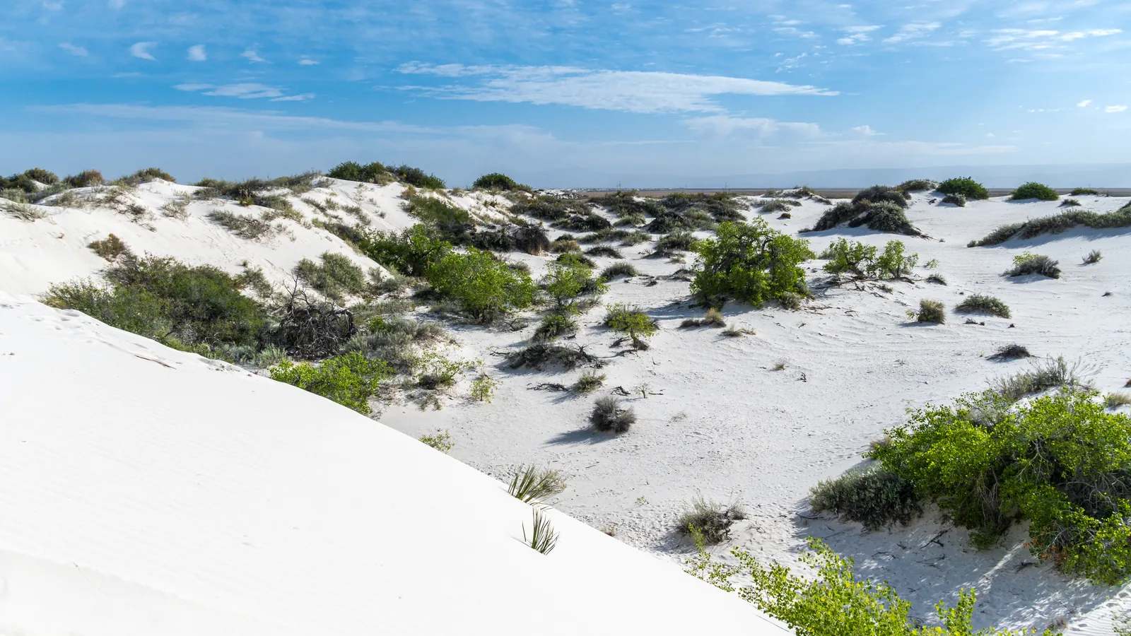
White Sands National Park is not on Route 66. It’s a southern detour from Albuquerque or Las Cruces into a gypsum dune field that photographs like snow and walks like soft beach. The gypsum itself is the trick worth knowing before you go barefoot: unlike regular quartz sand, it doesn’t hold heat, so the dunes stay cool underfoot even on a July afternoon when the air is triple digits - one of the only desert walks in the state where the ground is kinder than the sky. Entry is $25 per private vehicle ($20 motorcycle, $15 per person on foot or bike if you’re 16+), valid seven days. An America the Beautiful pass covers it. The park closes for missile tests on White Sands Missile Range - check the NPS closures page the morning you drive, not the night before from a dead-zone motel. Farther southeast, Carlsbad Caverns is a different day entirely: timed entry for the cave, a steep Natural Entrance walk and a free evening bat flight in season.
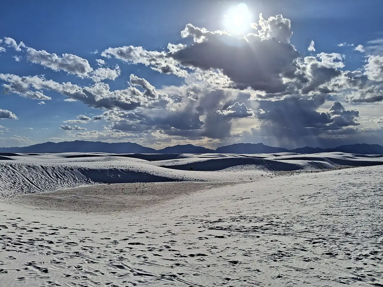
Sleds are sold on site if you didn’t bring one. Backcountry camping has been unavailable with no reopen date published as of the latest NPS visitor notes - don’t plan an overnight in the dunes until that changes. A half day is enough for Dunes Drive and a short walk; a full day only if you’re a photographer chasing sunset.
Red or green, and when to come
Before you order dinner anywhere in the state, know the official state question, adopted in 1996: “Red or Green?” It means chile. If you can’t choose, say “Christmas” and you’ll get both. That is not tourist kitsch - servers ask it seriously.
Summer monsoon storms build almost every afternoon from July into September, which is worth planning around if White Sands is on the list - mornings run calmer than the afternoon build-up. Winter stays mild in Albuquerque but turns properly cold toward Santa Fe’s 7,000-foot elevation, with occasional snow dusting the plaza. Balloon Fiesta in early October fills every Albuquerque hotel for miles, so book early or stay outside the metro if you’re not there for the balloons - and buy session tickets only from the official seller before you arrive.
How long, and how to move
Three days: Albuquerque plus either Santa Fe or White Sands, not both at a sane pace. Five days: Santa Fe loop, Albuquerque, Tucumcari night, and a Gallup exit toward Arizona. A week lets you add White Sands without turning every day into a transfer.
Fly into ABQ. Rent a car. New Mexico’s cities are walkable in pockets; the state is not. Coming from the east you’ve already crossed Oklahoma; continuing west, Arizona’s Route 66 section is the scenic climax. If Santa Fe is the reason you came, start with the city guide and treat the rest of the state as optional days - not the other way around.
Signal, altitude and what to pack
One practical note overseas visitors miss: cell coverage drops between Tucumcari and the mountain stretches toward Santa Fe, and maps that worked fine in Oklahoma City will quietly fail to reroute you out here. Download offline maps before you leave Albuquerque, keep a paper atlas in the glove box if you’re doing the old alignments, and don’t plan to book tonight’s motel from the shoulder of US-84.
Pack for altitude and sun even when the forecast looks mild. Albuquerque sits around 5,000 feet; Santa Fe is higher; White Sands reflects enough light to burn skin on cool days. A hat and more water than you’d carry back in Missouri are not overkill, and gas is reliable on I-40 but thinner once you leave it for old alignments or the southern dune road - fill up in town.
New Mexico simply runs bigger than Oklahoma or Texas behind you, and the map compresses those distances more than the road ever will. Load the offline maps before Albuquerque, decide Santa Fe versus the cutoff with a clear head, and treat the altitude change as real instead of a number on a sign. Get that part right and the empty stretches between towns stop feeling like a warning - they’re most of the reason this state stays with people longer than the neon does.
On the map
The map loads on click - to keep the page lightweight.
The map didn’t load. Check your connection and refresh the page.
Good to know
White Sands fees and missile-range closures change; Santa Fe museum tickets change by season. Confirm on nps.gov/whsa and nmculture.org before you go.
Details checked: August 10, 2026
Read also

States · 11 min read
Connecticut: Mystic, New Haven and the Shoreline
Verified · September 12, 2026Mystic Seaport at $35 adult, free Yale galleries in New Haven, and Gillette Castle on the river - how a Connecticut weekend actually fits.

States · 9 min read
North Dakota: Medora and Theodore Roosevelt NP
Verified · September 5, 2026The 36-mile South Unit loop starts in Medora, entrance $30 per vehicle, cashless from May 2026 - how to plan Theodore Roosevelt National Park.

States · 9 min read
Arkansas Travel Guide: Hot Springs & Ozarks
Verified · September 4, 2026Fee-free Hot Springs NP downtown, free Crystal Bridges in Bentonville, and the 135-mile Buffalo - how to string an Arkansas road trip.

States · 10 min read
Indiana Travel Guide: Indy, Speedway, Shore
Verified · September 5, 2026IMS Museum at $25, Kiss the Bricks at $15, Brown County hills and Lake Michigan shore - an Indiana trip beyond a Chicago beach day.