
Illinois Travel Guide
Chicago, the start of Route 66 in its centennial year, Lincoln sites in Springfield and canyon country downstate: what to see in Illinois and when.
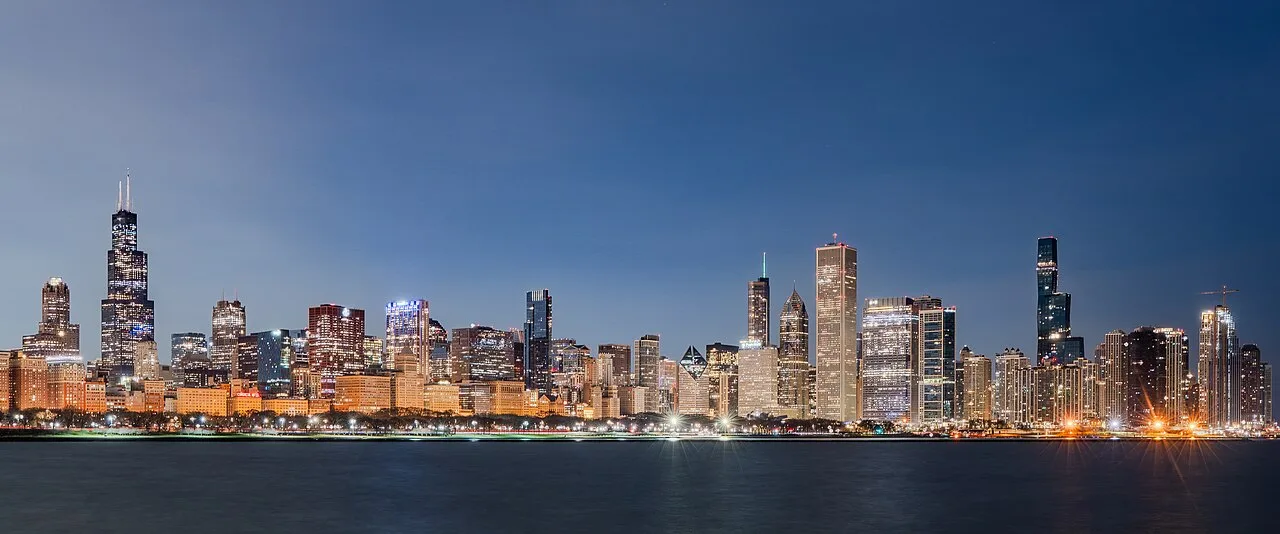
Illinois is a Chicago trip for most visitors, and that’s a defensible choice: the city holds the architecture, the museums, the food and both airports. But the state runs almost 400 miles south of it, and the two things downstate does better than anywhere else are Abraham Lincoln and Route 66. Four days in Chicago plus one day trip covers a first visit. Where to sleep for those four days is its own decision, and River North, the Loop and the Gold Coast suit different kinds of visit. Add a second Illinois leg only if Lincoln or the Mother Road is the reason you came.
The geography is simple and it drives everything. Chicago sits in the far northeast corner on Lake Michigan, close enough to Wisconsin and Indiana that you can leave the state by accident. Everything else spreads out across flat farmland: Springfield, the state capital, is about 200 miles southwest; the old Route 66 alignment runs diagonally between them; and the far south, past St Louis, turns into forested hills that surprise people who think Illinois is one long cornfield. That same lake is the west coast of Michigan a few hours north - the state, not Chicago’s Michigan Avenue. Across the lake in Indiana, Indiana Dunes National Park makes an easy beach day from Chicago when you have a spare Saturday.
Chicago: how many days
Three days is tight, four is right. That’ll buy you an architecture river cruise, a morning in Millennium Park and the Art Institute, one afternoon in a lakefront museum, a night of blues or comedy, and an outing to a neighborhood that isn’t downtown - our guide to things to do in Chicago sequences all of it. The lakefront is the part people underestimate: 18 miles of separated bike path and 18.5 miles of pedestrian path run along the water from Ardmore Avenue down to 71st Street, and renting a bike for a morning shows you more of the city than any bus tour.
Transit is cheap and easy. CTA charges $2.50 on the ‘L’ and $2.25 on buses (the airport run has its own rules - see O’Hare to downtown Chicago), with a day pass at $6 and a 7-day pass at $25. Both airports are on the train: the Blue Line to O’Hare, the Orange Line to Midway.
Route 66 starts here, and 2026 is its hundredth year
The Mother Road was commissioned on 11 November 1926 and ran about 2,448 miles from downtown Chicago to Santa Monica, which makes this year its centennial. Illinois has roughly the first 300 miles of it, and unlike the desert stretches out west, this section is fully drivable, with the old alignment shadowing I-55 through Joliet, Pontiac, Bloomington, Springfield and on to the Mississippi.
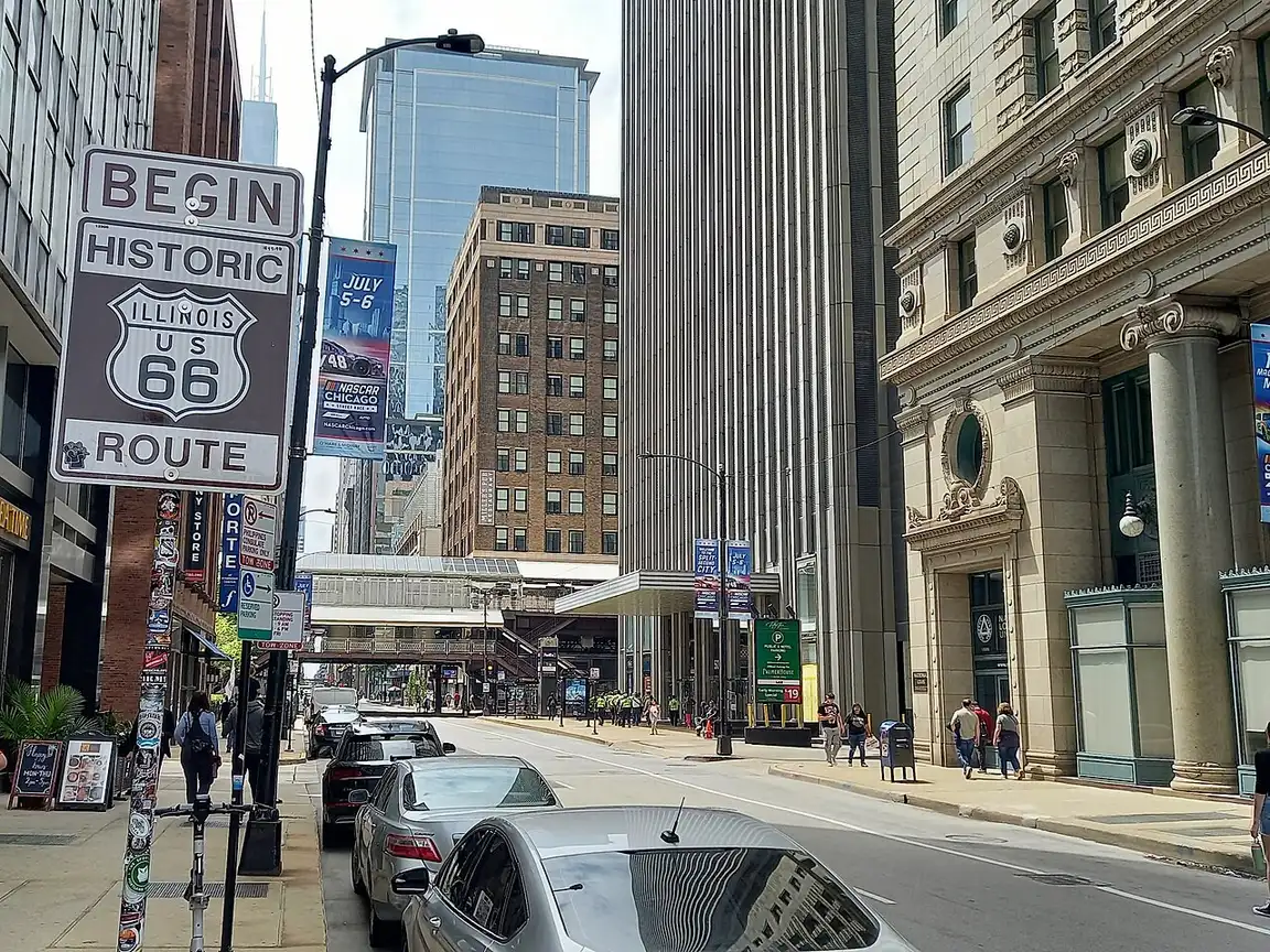
There’s a wrinkle worth knowing before you go looking for the start line. In February 2026 the City Council passed a resolution naming Navy Pier the official starting point, and a new Begin Route 66 sign went up there on 25 March, giving the road a pier-to-pier symmetry with Santa Monica. The sign everyone has photographed since 1955, on Adams Street at Michigan Avenue outside the Art Institute, is still standing. If you want the classic shot, go to Adams; if you want the one the city now calls official, go to the pier. Doing both takes twenty minutes and one train ride.
Pontiac has the Route 66 Hall of Fame and a wall of murals; Atlanta and Wilmington have the roadside giants; Springfield has the Cozy Dog Drive In, which has been claiming credit for the hot dog on a stick since 1946. Chicago to St Louis on the old road is a comfortable two days if you stop, five hours if you just take the interstate.
The full drive, Chicago to Santa Monica, is in our Route 66 road trip guide. From St. Louis the next state west is Missouri - Arch, Springfield and the Ozarks if you’re continuing on the Mother Road.
Springfield and the Lincoln sites
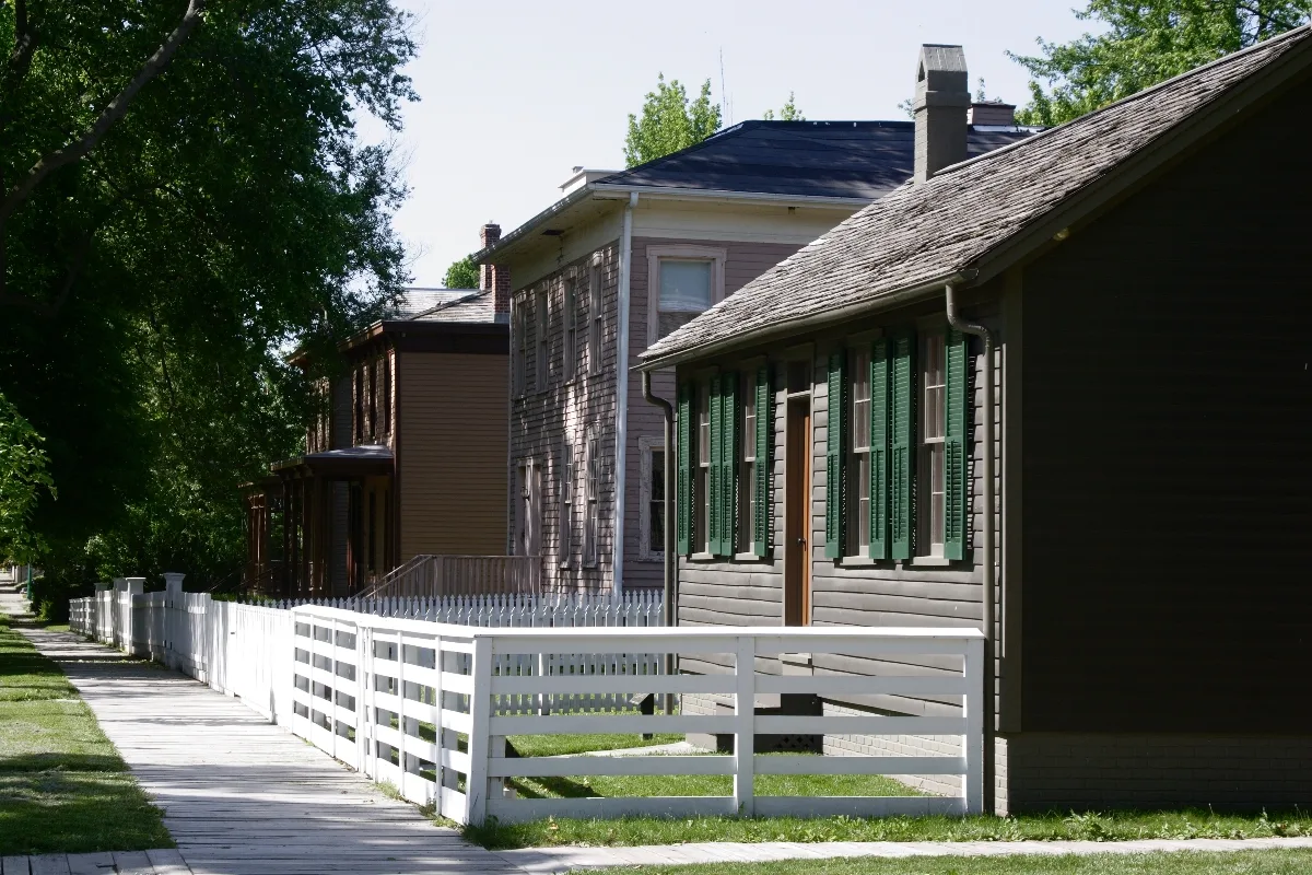
Springfield is the one downstate city that earns an overnight, and the reason is that the Lincoln material here is real rather than reconstructed. He lived in the house on Eighth Street for 17 years, and the National Park Service keeps it as it was: entry is free, but only on a ranger-led tour, and the free tickets come from the visitor center desk on the day. In peak months they can run out before the last tour of the afternoon, so make it your first stop rather than your last.
The Abraham Lincoln Presidential Library and Museum a few blocks away is the ticketed one: $15 for adults, $12 for seniors and students, $6 for children 5 to 15. It’s unapologetically theatrical, with full-scale tableaux and two theater shows, and it works especially well for anyone traveling with teenagers who’d otherwise glaze over at another period parlor.
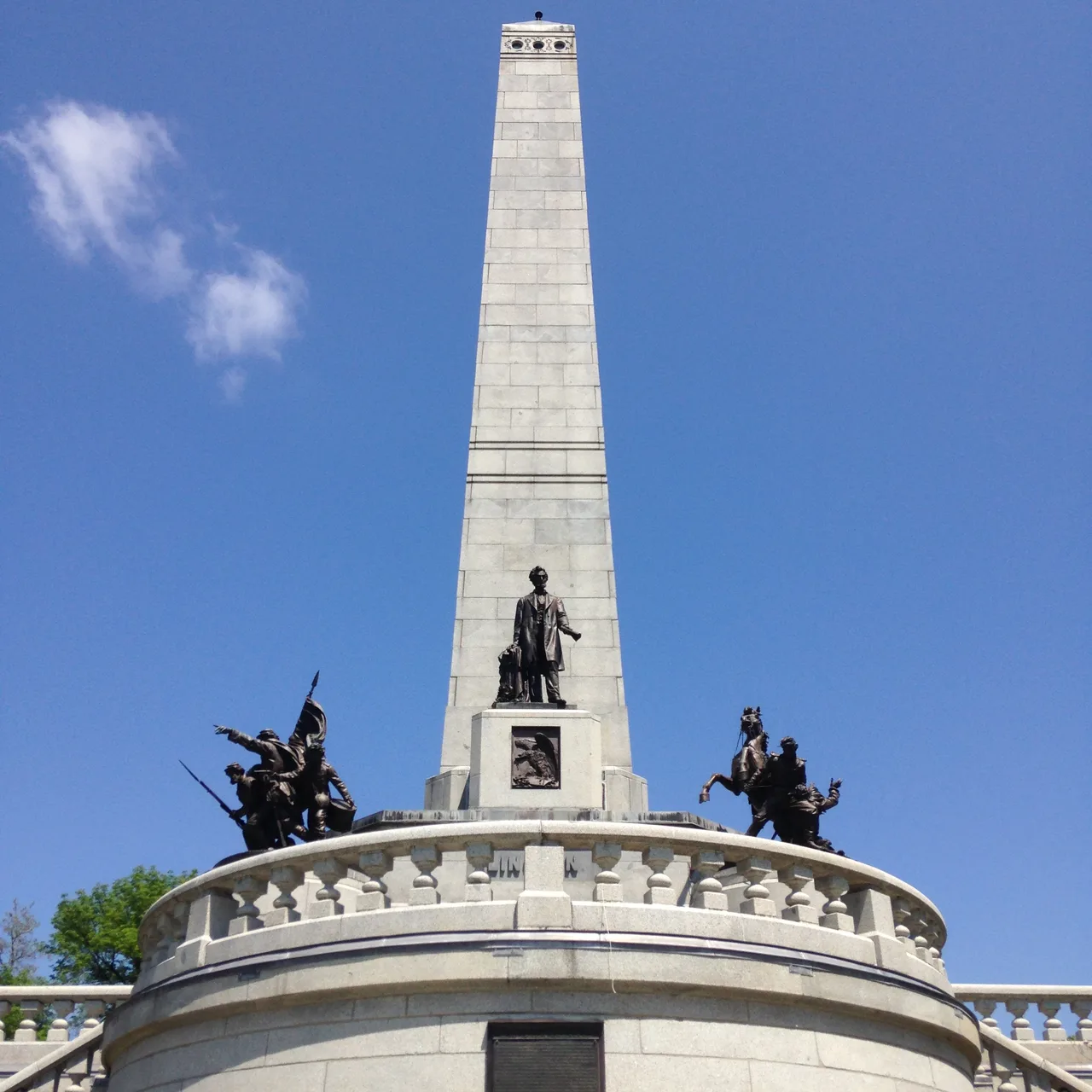
Finish at Oak Ridge Cemetery, where the tomb is free and open daily from 9am to 5pm. Time it for a Tuesday evening between June and August and you get the flag-lowering ceremony performed by volunteers in Civil War uniform at 7pm, which is the quietest and least commercial thing in Lincoln tourism.
You don’t need a car for this. Amtrak’s Lincoln Service does Chicago to Springfield in under three hours at up to 110 mph, and the station is a ten-minute walk from the Lincoln Home.
The Illinois nobody photographs
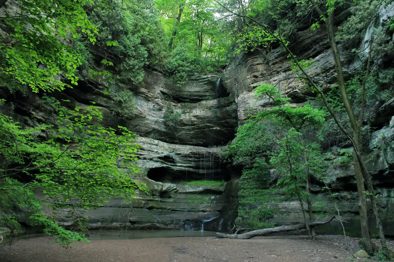
Starved Rock State Park, about 95 miles southwest of Chicago on the Illinois River, has 18 canyons cut into St Peter sandstone and more than 13 miles of trails. It opened in 1911 as the state’s second park and it is the closest thing to hiking terrain within a day trip of the city. Time it right: the waterfalls in those canyons are fed by rain and snowmelt, so spring is when they run and August is when they’re a damp streak on a rock wall.
Garden of the Gods, in the Shawnee National Forest at the southern tip of the state, is about five and a half hours from Chicago and looks like it belongs in Utah - sandstone bluffs over a sea of forest, best in mid-October when the hardwoods turn. Nobody drives there from the city on a short trip, but it belongs on the map if you’re passing between Chicago and Nashville or Memphis.

Galena, in the far northwest, is a preserved 19th-century lead-mining town with Ulysses S. Grant’s house and a main street of brick storefronts, three hours from Chicago and a standard Midwest weekend. North along the lake, Illinois Beach State Park gives you dunes and swimming without leaving the state.
Winter is not a rumor
Chicago’s January normals are an average high of 31.6F and an average low of 18.8F, with 11.3 inches of snow across the month. Those are averages; the cold snaps that make the news are well below them, and the wind coming off the lake makes the number on your phone feel optimistic. None of that ruins a city trip - the museums, the food and the blues clubs are indoors, and hotel rates in January and February are the lowest of the year - but it does rule out the lakefront, the boat cruises and any downstate hiking. Architecture cruises run roughly mid-March to late November for exactly this reason.
The best weather is late May to mid-June and all of September into early October: warm, dry-ish, and either side of the humid stretch of July and August. Fall is also when downstate is at its best, with the Shawnee forest turning in mid-October and Route 66 free of summer traffic.
On the Chicago-Denver corridor, the next farmland stretch is our Iowa travel guide.
Getting around
Chicago is a no-car city. Both airports connect by train, the ‘L’ covers the tourist map, and downtown parking is an expensive solution to a problem you don’t have. Everywhere else in Illinois assumes a car, with two exceptions: Springfield by Amtrak, and St Louis on the same line if you’re continuing south.
If you’re driving the state, distances are long but the roads are fast and flat, and gas is cheaper than either coast. The one thing to plan for is tolls: the Chicago area runs on the I-PASS/E-ZPass system, and rental companies charge a daily fee for their transponder whether or not you use it, so ask at the counter and consider paying the tolls online instead. Coming from the east, Illinois pairs naturally with a longer run through New York State or a stop in Massachusetts at the other end of the Great Lakes corridor.
Read also
- The city in full: things to do in Chicago
- Next on Route 66: Missouri travel guide
- Compare a coastal trip: Massachusetts travel guide
- Big-city alternative: things to do in New York City
- Browse more US states and US cities
On the map
The map loads on click - to keep the page lightweight.
The map didn’t load. Check your connection and refresh the page.
Good to know
Museum admission and transit fares here were checked in July 2026 and change without much notice - confirm on the operator site before you buy.
Details checked: July 24, 2026
Read also

States · 11 min read
Connecticut: Mystic, New Haven and the Shoreline
Verified · September 12, 2026Mystic Seaport at $35 adult, free Yale galleries in New Haven, and Gillette Castle on the river - how a Connecticut weekend actually fits.

States · 9 min read
North Dakota: Medora and Theodore Roosevelt NP
Verified · September 5, 2026The 36-mile South Unit loop starts in Medora, entrance $30 per vehicle, cashless from May 2026 - how to plan Theodore Roosevelt National Park.

States · 9 min read
Arkansas Travel Guide: Hot Springs & Ozarks
Verified · September 4, 2026Fee-free Hot Springs NP downtown, free Crystal Bridges in Bentonville, and the 135-mile Buffalo - how to string an Arkansas road trip.

States · 10 min read
Indiana Travel Guide: Indy, Speedway, Shore
Verified · September 5, 2026IMS Museum at $25, Kiss the Bricks at $15, Brown County hills and Lake Michigan shore - an Indiana trip beyond a Chicago beach day.